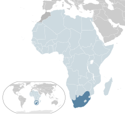
Complete ecotouristic information database on national parks of Republic of South Africa.
Republic of South Africa, is a country located at the southern tip of Africa. It has 2,798 kilometres of  coastline that stretches along the South Atlantic and Indian oceans. To the north lie the neighbouring countries of Namibia, Botswana and Zimbabwe; to the east are Mozambique and Swaziland; and within it lies Lesotho, an enclave surrounded by South African territory. South Africa is the 25th-largest country in the world by land area (1,219,912 km2), and with close to 53 million people, is the world's 24th-most populous nation.
Mafadi in the Drakensberg at 3,450 m is the highest peak in South Africa.
The interior of South Africa consists of a vast, in most places, almost flat, plateau with an altitude of between 1,000 m and 2,100 m, highest in the east, sloping gently downwards towards the west, south and north. This plateau is surrounded by the Great Escarpment whose eastern, and highest stretch is known as the Drakensberg.
The south and south-western parts of the plateau are known as the Great Karoo, which consists of sparsely populated scrubland. To the north of the Karoo is the drier and more arid Kalahari desert. The mid-eastern, and highest part of the plateau is known as the Highveld. This relatively well-watered area is home to a great proportion of the country’s commercial farmlands, and contains its largest conurbation. To the north of Highveld, from about the 30° S line of latitude, the plateau slopes downwards into the Bushveld, which ultimately gives way to the Limpopo lowlands or Lowveld.
The Kruger National Park occupies a large portion of the Lowveld. South of the Lowveld the annual rainfall increases as one enters KwaZulu-Natal Province, which, especially near the coast, is subtropically hot and humid.
The narrow coastal strip between the seaward Cape Fold Mountains range and the ocean has a high year-round rainfall, especially in the George-Knysna-Plettenberg Bay region, known as the Garden Route. It is famous for the most extensive areas of indigenous forests in South Africa (a generally forest-poor country). In the south-west corner of the country the Cape Peninsula forms the southernmost tip of the coastal strip which borders the Atlantic Ocean, and ultimately terminates at the country’s border with Namibia at the Orange River. The Cape Peninsula has a Mediterranean climate, making it and its immediate surrounds the only portion of Africa south of the Sahara which receives most of its rainfall in winter.
The region further north is known as Namaqualand, becomes more and more arid. The little rain that falls, tends to fall in winter, which results in one of the world’s most spectacular displays of flowers carpeting huge stretches of veld in spring (August – September).
South Africa also has one possession, the small sub-Antarctic archipelago of the Prince Edward Islands, consisting of Marion Island (290 km2) and Prince Edward Island (45 km2) (not to be confused with the Canadian province of the same name).
South Africa has a generally temperate climate, due in part to being surrounded by the Atlantic and Indian Oceans on three sides, by its location in the climatically milder southern hemisphere and due to the average elevation rising steadily towards the north and further inland. Due to this varied topography and oceanic influence, a great variety of climatic zones exist. The climatic zones range from the extreme desert of the southern Namib in the farthest northwest to the lush subtropical climate in the east along the Mozambique border and the Indian Ocean. Winters in South Africa occur between June and August.
Detailed information on Republic of South Africa National Parks.
There is a database of this country national parks available. If you have any question or request you can send it by attached Informative Form.