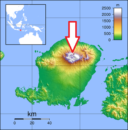
Basic ecotouristic information on Gunung Rinjani National Park (Lombok, Indonesia) which can be visited - localization, access, characteristic, fauna and flora, possible activities.
Localization
Central Lombok; 85 km from Mataram
Access
Quite difficult. 2,5 hours by car from Mataram to the park entrance.
Characteristic
413 km2; Mountainous area with altitude from 550 to 3,726m. Active volcano, the third highest mountain of Indonesia - 3,726m. On the top of the volcano is a 6-by-8.5-kilometre caldera, which is filled partially by the crater lake known as Segara Anak. It is located 600 meters below the crater rim and estimated to be about 200 metres deep. There are three famous caves (Goa Susu, Goa Payung and Goa Manik). Typical ecosystems: sub-montane rain forest, montane forest, savanna, volcanic biotopes.
Fauna + Flora
Species List - See the Attachment
Possible activities
Mountain climbing. Very difficult summit trek.
The three-day Rinjani trek route from Senaru to the crater rim, down to the Crater Lake then on to Sembalun Lawang, is considered one of the best treks in South East Asia.
Note
Segara Anak Lake (2,208 m asl.) whose sulphurous-smelling water has different temperatures from one part of the Lake to another, ranging from cool, through warm, to very hot.
A new volcano is emerging from the centre of Segara Anak Lake, and it is still active and growing.
Thermal springs.
Best time to visit: VIII-XII