Basic ecotouristic information on Paparoa National Park (New Zealand) - localization, access, characteristic, fauna and flora, possible activities.
Localization
Western coast of the New Zealand´s South Island, near the towns of Westport, Greymouth, and Barrytown.
Access
Easy. Along the Highway 6 that connects it with nearby towns: Westport and Greymouth.
Characteristic
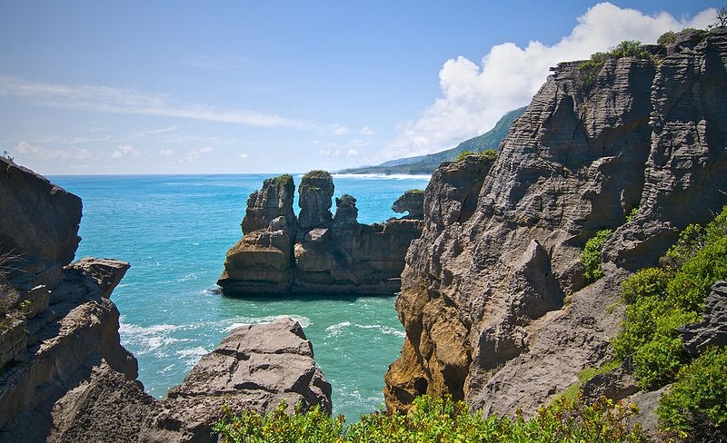
306 km2; Coastal areas and ajdacent limestone mountain range, karst formations, caves, deep canyons, blowholes and uderground rivers. A separate section of the park lies to the north and is centered at Ananui Creek. More than half the park is best described as mountainous. Wild untouched nature, unique plant communities. The park is the overlapping point between subtropical and cool climate trees. The southernmost place where tree ferns and palms grow together. The Paparoa coastline is characterised by high cliffs. Typical ecosystems: temperate zone forests, freshwater ecosystems (rivers), marine and coastal ecosystems,karst biotopes.
Fauna + Flora
Species List - See the Attachment Below.
Possible activities
Trekking - several paths of different lenght including short walking paths
Caving, canoeing, surfing
Note
Extraordinary beautiful landscape - especially coastline
The most famous attraction - "Pancake Rocks"
Best time to visit XI-III.